Boonie Stomp

ENJOY THESE EVENTS AS THEY HAPPEN ACROSS MICRONESIA!
E.g., 04-17-2024
E.g., 04-17-2024
*Choose booth start and end dates
GUAM

Boonie Stomps - Mark Lander’s Memorial Anao Hike

August 13    Mark Lander’s Memorial Anao Hike     Very Difficult    3 miles
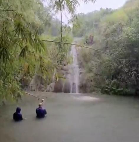
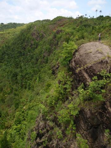
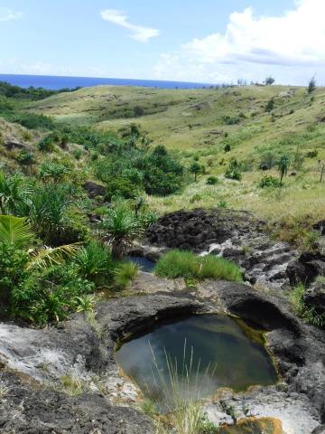
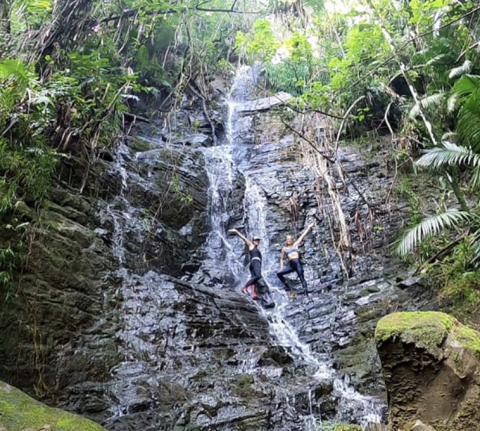
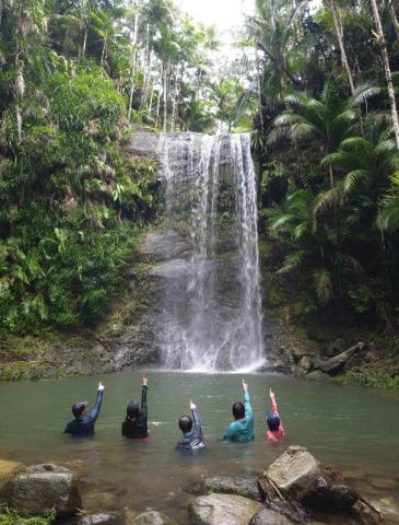
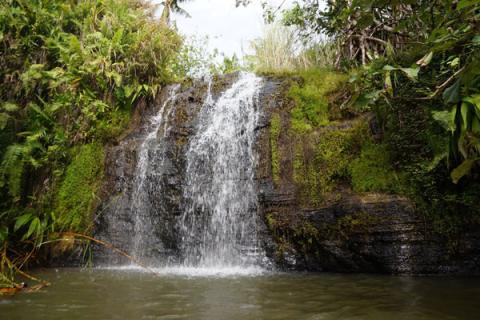
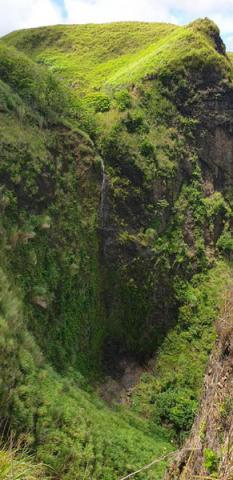
We descend the northeastern cliff to the isolated, beautiful coastline of northeast Guam. We walk along the coastal cliffs to see beautiful views and caves.
Bring: 4 quarts water, electrolytes, hiking shoes, sun screen, sunglasses, lunch and snacks, and camera
Special Conditions: Hiking over rough sharp rocks, climbing steep slopes/boulders, climbing w/rope, little shade, and a long ascent at the end.
Parking Location: Google Maps or Apple Maps: 13.54648187329503, 144.92399199136582 (Anao Trailhead)
GUAM

Boonie Stomps - Guatali, Guam

August 6    Guatali     Very Difficult    4 miles
We hike from the central mountains of Guam into a pristine valley with 4 large waterfalls, one jumping spot, with swimming hole.
Bring: 4 quarts water, sturdy hiking shoes that can get wet, swimsuit, gloves, sun screen, sunglasses, insect repellent, lunch, and camera.
Special Conditions: Rocky steep downhill trail, walking in water, slippery rocks, short steep climbs down, sword grass, a long hike.
Parking Location: Google maps or Apple Maps - 13.4526850, 144.7164698 (San Carlos Trailhead)
GUAM

Boonie Stomps - Malojloj Waterfall Valley

July 30    Malojloj Waterfall Valley     Medium    3 hours for 1 mile
We visit the large Upper Falls for jumping and swimming fun. We then have a choice of walking down the river and on jungle trail (hard) or returning to the cars and walking down the road to reach the large middle falls, then take the trail down to the lower falls for jumping, swimming, and exploring.
Bring: 2 quarts water, wet shoes, sun screen, insect repellent, lunch, and camera
Special conditions: Walking in water, slippery rocks and mud, and mosquitoes.
Parking Location: Google Maps or Apple Maps: 13.2942220, 144.7533223 (Side of the road in grassy area)
GUAM

Boonie Stomps - Invasion Hike

July 23    Invasion Hike     Very Difficult    6 hours for 5 mile
The Invasion hike retraces the trail of the US 3rd Marines from Asan Beach up the hills and cliffs to Nimitz Hill and the Asan Bay Overlook Memorial. We then hike the open ridge down to Tony’s Falls for jumping and swimming.
Bring: 4 quarts water, hiking shoes, sun screen, lunch and snacks, and camera.
Special Conditions: Sword grass and steep slopes
Parking Location: Google Maps or Apple Maps: 13.4561332 144.7070187
GUAM

Boonie Stomps - Faha/Priests Pools

July 16    Faha/Priests Pools     Medium    3 hours for 1 mile
We hike to the Faha Memorial in Merizo where village residents were massacred just before the Liberation of Guam. We then walk along a narrow ridge with spectacular views to cool off in the freshwater pools of the Pigua River, with waterfalls, jumping, and swimming.
Bring: 2 quarts water, get wet shoes, swim suit, sun screen, insect repellent, lunch, and camera.
Special Conditions: Possible Muddy Trail & Mosquitoes
Parking Location: Google Maps or Apple Maps: 13.2718896, 144.6636598
GUAM

Boonie Stomps - Malaa

July 09    Malaa     Difficult    3 hours for 3 mile
We hike jeep trails, down an overgrown ridge, descend to the falls, then after a short rest we will travel down stream to a beautiful 3 tiered waterfall then climb out and back up to the jeep trails.
Bring:2 quarts water, wet shoes, sun screen, insect repellent, lunch, and camera
Special Conditions: Sword grass, little shade, slippery rocks, river walking, steep & muddy slopes.
Parking Location: Google Maps or Apple Maps: 13.4526850, 144.7164698 (San Carlos Trailhead)
GUAM

Boonie Stomps - San Carlos

July 02    San Carlos     Medium    4 hours for 4 mile
We visit two beautiful waterfalls in central Guam with swimming, jumping, and also walk along two pristine jungle rivers.
Bring: 3 quarts water, sturdy hiking shoes that can get wet, swimsuit, gloves, sun screen, sunglasses, insect repellent, lunch, and camera.
Special conditions: Steep slopes, walking in water, mud, rocky river, and climbing with a rope.
Parking Location: Google maps or Apple Maps - 13.4526850, 144.7164698 (San Carlos Trailhead)
GUAM

Boonie Stomps - Tinechong Falls (Brittany’s Falls)

June 25    Tinechong Falls (Brittany’s Falls)    Double Difficult    5 hours for 5 miles
We travel to the very center of Guam to explore a 20 ft waterfall with a very deep freshwater swimming hole and fun jump.
Bring: 4 liters water, hiking boots, gloves, sun screen, insect repellent, lunch, and camera.
Special conditions: Swordgrass, river crossing, rope climb, and a muddy swamp.
Parking Location: Google Maps or Apple Maps: 13.35321, 144.74787 (Side of the road - 4A)
GUAM

Boonie Stomps - Mt. Sasalaguan/Tak’kilo Falls/Knife's Edge

June 18    Mt. Sasalaguan/Tak’kilo Falls/Knife's Edge    Double Difficult    6 hours for 5 miles
We hike to the top of the highest waterfall on Guam, situated in a deep, narrow, blind canyon. We then travel down the bridal trail, where we cross the “knifes edge”, with amazing views of Tak’kilo Falls.
Bring: 4 quarts water, hiking shoes, gloves, sun screen, lunch and snacks, and camera.
Special Conditions:Possible mud, sword grass, steep slopes up and down, high narrow areas, and a long hike.
Parking Location: Google Maps or Apple Maps: 13.2648351, 144.7154777 (IJA Experimental Farm Rd)
GUAM

Boonie Stomps - Mt Tenjo to Tarzan Falls

June 11    Mt Tenjo to Tarzan Falls    Double Difficult    5 hours for 4 miles
We hike Mt Tenjo’s knifes edge, descend to the Maguagua Valley, and over to Tarzan Falls.
Bring: 3 to 4 quarts of water, sturdy hiking shoes that can get wet, gloves, sunscreen, insect repellent, lunch, snacks, and camera.
Special Conditions:Sword grass, jungle walking, and long distance with little shade and steep or muddy slopes for the Tarzan Falls option.
Parking Location: Google Maps or Apple Maps: 13.3878319, 144.7221494 (Tarzan Falls Trailhead)

Pages